
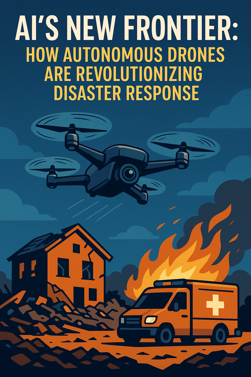
When
wildfires swept through the Los Angeles region in January 2025, autonomous
drones were deployed within hours of ignition, providing continuous aerial
monitoring that ground crews and conventional aircraft could not match. The
drones flew predetermined survey patterns, identified active fire fronts
using thermal imaging, transmitted real-time data to incident command
systems, and autonomously adjusted their flight paths to maintain coverage of
the fastest-spreading sections of the fire perimeter. The human incident
commanders who directed the response described the drone intelligence as
transforming their situational awareness in ways that changed how they
allocated resources and which communities they prioritised for evacuation.
Autonomous drones in disaster response are not a future technology waiting
for deployment. They are operational tools that are already making emergency
management faster, safer, and more effective in some of the most challenging
conditions that first responders face.
The combination of autonomous flight, AI-powered sensing, and
real-time data transmission represents a significant capability step beyond
the remotely piloted drones that have been used in emergency response for the
past decade. Remotely piloted drones require a trained operator maintaining
line-of-sight or video link control throughout each flight, limiting the
number of drones that can be operated simultaneously and the distance they
can cover from ground control stations. Autonomous drones that fly
pre-programmed missions, adjust to environmental conditions, and coordinate
their coverage patterns without continuous human control can deploy in larger
numbers, cover wider areas, and maintain operations through periods when
communication links are degraded. These advantages are significant in
large-scale disasters where the area to be monitored exceeds what any
feasible human-controlled drone fleet could cover.
Search and Rescue Applications
Autonomous drone search and rescue represents one of the most
compelling applications of the technology, combining the speed and coverage
advantages of aerial search with AI-powered detection capabilities that
exceed what human eyes scanning from a helicopter can achieve. AI computer
vision systems trained on thermal and visual signatures of people in distress
can identify potential survivors in complex environments, including dense
vegetation, rubble, and low-visibility conditions, with sensitivity that
human observers cannot maintain over extended search periods. The Royal
National Lifeboat Institution has piloted autonomous drone search tools for
maritime and coastal search operations, finding that AI-assisted aerial
search can cover coastal areas in a fraction of the time required by
conventional search patterns while maintaining higher detection rates for
people in the water.
Mountain rescue organisations including several UK mountain rescue
teams have integrated autonomous drones with AI detection into their
operational procedures. In missing person searches across upland terrain, the
combination of autonomous coverage of inaccessible areas with AI thermal
detection of human heat signatures has reduced search times significantly
and, in several documented cases, has located individuals that ground search
teams had not found after extended searches. The evidence base for autonomous
drone search and rescue is still being systematically assembled, but
operational experience from the teams that have adopted the technology is
consistently positive. Mountain Rescue England
and Wales has published operational guidelines for drone
integration that reflect this emerging evidence.
Damage Assessment and Infrastructure Inspection
Following major disasters, rapid assessment of structural damage
across large areas is critical for directing emergency repairs, allocating
shelter resources, and planning recovery operations. Traditional damage
assessment requires field teams to physically inspect affected areas, a
process that is slow, dangerous when infrastructure is compromised, and
produces assessment data that is days old by the time it informs resource
allocation decisions. Autonomous drone fleets equipped with high-resolution
imaging and AI damage classification can survey entire neighbourhoods in
hours, producing geo-referenced damage assessments that are available to
emergency managers within the same operational period as the event that
caused the damage.
After the Turkish earthquake of February 2023, drone-equipped
teams from several international organisations deployed autonomous survey
capabilities within 72 hours of the initial event. AI analysis of the
resulting imagery produced building damage assessments that were
substantially complete before conventional damage assessment teams had
completed their first survey transects. The quality and speed of AI-assisted
drone damage assessment has been validated against field assessment in
multiple post-disaster studies, with findings consistently showing that AI
classification of drone imagery matches expert field assessment on gross
damage categories while providing dramatically superior coverage and
timeliness.
Regulatory and Safety Frameworks
The regulatory framework for autonomous drone operations in the UK
is managed by the Civil Aviation Authority, which has developed a risk-based
approach to Beyond Visual Line of Sight operations that includes specific
provisions for emergency response applications. The CAA’s Emergency Services
exemptions allow operational flexibility for autonomous drone use in genuine
emergency response contexts that is not available for commercial operations,
recognising that the safety risk calculus is different when drones are being
used to protect human life rather than to deliver commercial value. The
challenge is that the regulatory frameworks were primarily developed for
remotely piloted aircraft and do not fully address the specific characteristics
of autonomously operating systems, including the question of how liability is
allocated when an autonomous drone causes harm while executing an emergency
response mission.
The Civil Aviation
Authority has published updated guidance on autonomous drone
operations that acknowledges the gap between current regulations and the
capabilities being deployed, and is developing a revised framework for fully autonomous
operations that balances safety requirements with the operational needs of
emergency response applications. The EU’s U-Space framework, which is being
progressively adopted across European airspace including the UK through
post-Brexit mutual recognition, provides the longer-term regulatory
architecture within which autonomous emergency response drones will need to
operate.
What This Means for You
If you live in an area prone to wildfires, flooding, or other
major disaster risks, autonomous drone technology is increasingly part of the
emergency response infrastructure designed to protect your community, even if
it is not yet widely deployed in your specific region. The evidence from
deployments in Los Angeles, in mountain rescue in the UK, and in
international disaster response is consistently positive about the value the
technology adds when integrated effectively into emergency response
operations. The governance challenges, regulatory frameworks, liability
questions, and airspace management requirements are real but solvable, and
they are being actively worked on by the organisations responsible for
emergency response capability. For related analysis, see our coverage of
AI
in disaster response and AI
in critical infrastructure.
Integration of autonomous drones with broader AI disaster
management systems represents the next development frontier. Drones sharing
data in real time with damage assessment platforms, resource allocation
systems, and communications infrastructure create a more capable integrated
response than any component provides alone. UK emergency services are
participating in research examining how drone intelligence feeds into
AI-assisted incident command decision support, with early results showing
measurably better resource allocation decisions compared to non-integrated
approaches. The Emergency
Planning College has developed training programmes for emergency
management personnel using AI-assisted drone intelligence, recognising that
realising the technology’s full value requires investment in human skills as
much as in the technology itself. The combination of autonomous drone
capability, AI analysis, and trained human command represents the operational
standard toward which UK emergency management is progressively
moving.
About the Author
Stuart Kerr is a technology correspondent at LiveAIWire, covering
artificial intelligence, digital innovation, and the social impact of
emerging technologies. Follow LiveAIWire for daily analysis at liveaiwire.com.